I developed this resource because the topic of glaciers and glaciation is sometimes perceived by students and teachers as being more difficult to introduce and engage with in the classroom than others associated with more familiar environments, such as rivers and coasts.
Of course, this can be addressed through well-designed fieldwork in areas with glaciers and/or glaciated landscapes. Unfortunately, fieldwork to these environments – if it takes place at all – often occurs at a different time in the year from when students are learning about them in class. In addition, fieldwork can occasionally be blighted by poor weather, illness, accessibility issues etc.
Through its on-demand, simulated fieldwork, this resource provides a solution to these challenges. I believe virtual fieldwork has an important role to play in the classroom and, as such, it can also help to underpin ‘real’ fieldwork – for which there is no substitute!
How does it work?
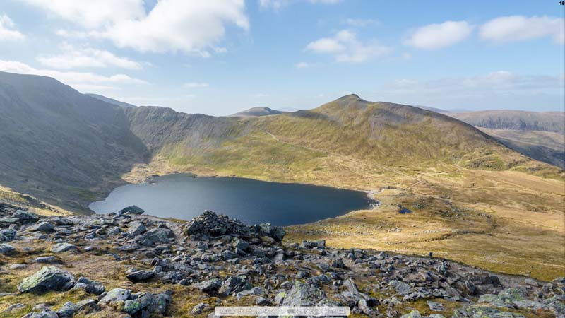
VR Glaciers and Glaciated Landscapes is based around high quality, 360 degree interactive panoramas (panospheres), which allow users to look all around and zoom in on features of interest. The panoramas are linked, so it is possible to proceed through the landscape, going from one panorama to the next. This provides a sense of scale and orientation, and helps users understand how the landscape changes from one location to the next.
In due course, the panoramas will include sound (for contemporary glacial environments), further contributing to the immersive experience, as well as links to other resources, such as 3D models and video.
Easy to use
The resources can be viewed on any modern device with an internet connection, including phones and tablets, but they are best appreciated on a large monitor or by using virtual reality headsets. There is no requirement for any browser plug-ins or other proprietary software, although the browser must be reasonably up-to-date (HTML 5 compliant). In other words, the resources are easy to use and there is no need for expensive equipment.
Although new to this site, the Deepdale virtual field trip has been available to University of Worcester students since 2014. It’s a really interesting location,
I'm a Physical Geographer based in Worcester, UK. My interests include mountain glaciers, mountain geomorphology and Quaternary environmental change. I'm also interested in the use of virtual reality in teaching.